





















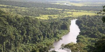
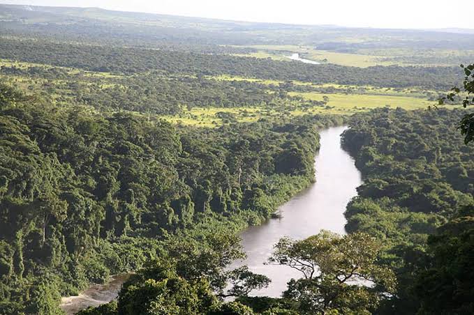
The Kwanza Corridor Cultural Landscape in the Republic of Angola represents one of the most complex geographical and historical spaces on the African continent. Stretching along the Kwanza River—the longest river located entirely within Angolan territory—this corridor forms a spatial domain where pristine nature intersects with accumulated layers of human history, ancient settlement, and colonial transformation. Given its significance, the site has been included on the UNESCO World Heritage Tentative List, reflecting a formal, international effort to recognise its enduring, trans-temporal value.
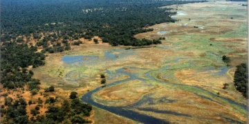
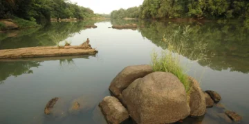
The Kwanza River begins its journey on the Bié Plateau in the centre of the country, traversing a vast distance before emptying into the Atlantic Ocean, south of the capital, Luanda. The Kwanza Corridor is characterised by a unique ecological diversity, linking coastal ecosystems and wetlands with open woodlands and relatively arid zones. Throughout the ages, the river has served as a vital lifeline for the surrounding valleys, providing the essential conditions for human settlement, including opportunities for fishing and agriculture.
From an environmental perspective, the basin boasts remarkable biodiversity, encompassing a wide array of fish, aquatic organisms, and terrestrial wildlife. Furthermore, it lies adjacent to major nature reserves, such as the Quicama National Park. This interplay between the riverbanks, its fresh waters, and the surrounding ecosystem created a harmonious environment inhabited by human groups for thousands of years. These communities developed techniques adapted to seasonal floods and hydrological cycles, taking advantage of the fertile alluvial soil that characterises the lower and middle Kwanza basin.
The Kwanza corridor served as a setting for the establishment and growth of major political and social entities that left an indelible mark on the history of Central Africa. The riverbanks and the surrounding valleys formed the cradle of the historic Kingdom of Ndongo and other Bantu societies that existed long before the arrival of Europeans. These kingdoms demonstrated advanced levels of social and political organisation, relying on extensive trade networks that linked the African interior to the Atlantic coast.
Economic resources—such as copper, iron, agricultural produce, and fish—provided the material foundation that enabled these societies to flourish. Over time, the river’s course evolved into a primary trade route for the transport of goods and the exchange of culture among various tribes. This indigenous African identity became intertwined with the leadership of historical figures who resisted external expansion, transforming the geography of the corridor into a repository of collective memory and a site for archaeological evidence—much of which is still being studied and documented by archaeologists and anthropologists today.
The Kwanza corridor reached a major turning point with the arrival of Portuguese explorers and seafarers in the late 15th and early 16th centuries. Because the river is navigable for a considerable distance inland—reaching approximately 150 miles from its mouth—it served as a primary gateway for Portuguese forces and settlers to launch military conquests and penetrate deep into the northern and central territories of Angola.
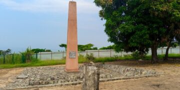
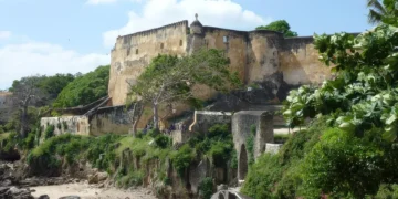
This colonial incursion led to the establishment of a network of forts, trading posts, and military settlements along the riverbanks—such as the town of Massangano and other strategic points—which played a pivotal role in controlling the slave trade and the extraction of natural resources. Old churches, dilapidated military fortifications, and colonial-era architectural ruins stand as tangible evidence of this dark period, a time marked by profound cultural and demographic trauma.
This architectural and cultural duality—characterised by the interweaving of colonial military structures with local African social systems—is what underpins the nomination of the “Kwanza Corridor Cultural Landscape” for UNESCO recognition. The site serves as a clear visual record of struggles for hegemony, exchanges both forced and voluntary, and a long history of exploitation that the region endured over the course of five centuries.
Despite the immense historical and environmental significance of the Kwanza Corridor, the site faces a complex array of contemporary challenges that threaten its integrity and sustainability. While its inclusion on the Tentative List for World Heritage status reflects the serious intent of both the Angolan government and the international community, transitioning from the tentative stage to full, definitive inscription requires intensified administrative and on-the-ground efforts.
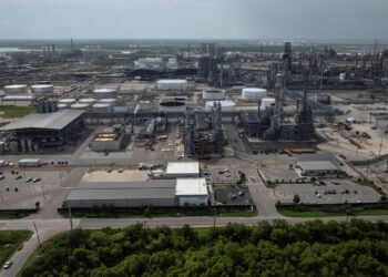
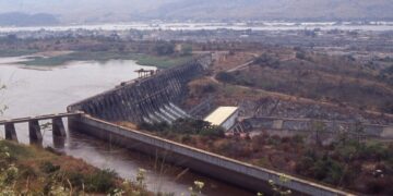
Among the most prominent challenges to preserving this landscape are unregulated urban expansion and major infrastructure projects—such as the construction of hydroelectric dams (including the Cambambe, Kapanda, and Laúca dams)—which have radically altered the river’s natural flow, as well as its ecological and sedimentary dynamics. Although these development projects are significant for Angola’s energy sector and national economy, they have resulted in the submersion of archaeological sites and the transformation of natural landmarks that are integral to the corridor’s cultural fabric.
The infrastructure dedicated to heritage protection and cultural tourism in the region suffers from inadequate funding and a shortage of personnel specialized in the maintenance of open-air archaeological sites. Unlike those in major cities or more centralized locations, the landmarks of the Kwanza Corridor are scattered across vast, distant geographical areas, making continuous monitoring—as well as the prevention of vandalism and illicit excavation—exceptionally difficult. Additionally, the legacy of the long civil war in Angola led, for an extended period, to the marginalization of investment in cultural heritage preservation, as resources were diverted toward more urgent security and basic living priorities. An objective view of the Kwanza Corridor cultural landscape requires avoiding romanticized exaggerations that might portray the site as a ready-made tourist paradise or a fully realized open-air museum. In reality, the corridor reflects the contradictions of development in contemporary Angola: it encompasses both stark, impoverished conditions and the marginalization of local communities on one hand, and elite-focused tourism investment projects—concentrated near the river’s mouth (Barra do Kwanza)—on the other.
To achieve genuine and sustainable protection for this heritage, there is an urgent need to formulate comprehensive national policies that balance the requirements of economic development and energy generation with the preservation of the landscape’s ecological and physical integrity. This necessitates engaging the local communities living along the riverbanks—the true guardians of this heritage—and ensuring they benefit directly from any future tourism or cultural initiatives.