


The Land of Punt is one of the most controversial geographical and political entities in the study of ancient history and Egyptology. Known in ancient Egyptian texts as Ta Netjer (or Ta-Ntr), meaning “Land of the God”, it was a strategic trading partner for the ancient Egyptians for over two thousand years. Despite the wealth of Egyptian archaeological records detailing expeditions to Punt, its precise geographical location remains a subject of extensive academic debate based on the analysis of texts, biological remains, and climatic evidence.
The relationship between Egypt and the Land of Punt began early in the history of the Egyptian state. Historical evidence suggests that trade was organised through state-sponsored expeditions.
The first explicit reference to the Land of Punt appears on the Palermo Stone, dating to the reign of King Sahure of the Fifth Dynasty (25th century BCE). The texts mention that the expedition returned with 80,000 measures of antiu (myrrh) and 6,000 units of electrum (an alloy of gold and silver), in addition to ebony wood. References also exist during the reign of King Djedkare Isesi to the bringing of a dwarf from Punt, a detail reiterated during the reign of King Pepi II of the Sixth Dynasty in a letter attributed to the commander Harkhuf.
The Eleventh Dynasty witnessed a resurgence of expeditions. Commander Henu-Akhet, during the reign of King Mentuhotep III, recorded details of his expedition from Wadi Hammamat to the Red Sea coast, where he built ships to sail towards Punt. During the Twelfth Dynasty, the “Tale of the Shipwrecked Sailor” (a literary text from that period) mentions Punt as an island rich in frankincense and perfumes, reflecting the island’s significant place in the Egyptian consciousness.
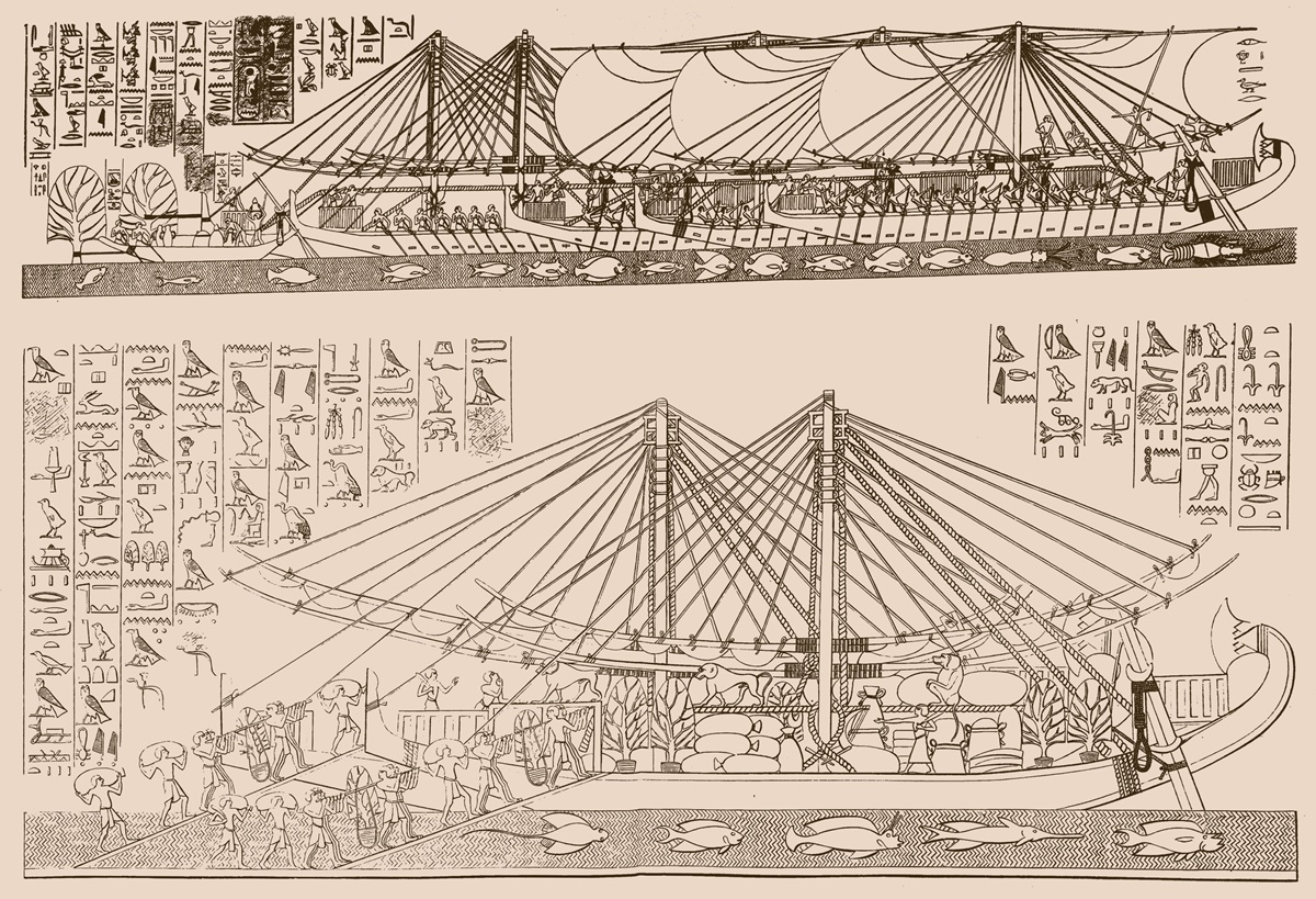
The expedition of Queen Hatshepsut (18th Dynasty, 15th century BC) is considered the most important and detailed source about the Land of Punt. Details of this voyage are inscribed on the walls of the Deir el-Bahari temple in Luxor. The inscriptions included precise details about the ships, the types of goods carried, and even the physical characteristics of the inhabitants of Punt and their dwellings. Expeditions continued under later kings such as Thutmose III, Amenhotep III, and Ramesses III of the 20th Dynasty, with the last of the great expeditions being recorded in the Papyrus Harris I.
The ancient Egyptians did not leave a map precisely pinpointing the location of Punt but described it as being southeast of Egypt and accessible via the Red Sea. Scientific hypotheses fall into three main categories:
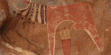
Hypothesis 1: The Horn of Africa (Ethiopia, Eritrea, Somalia): This hypothesis is based on the similarity between the products mentioned in the texts (frankincense, ivory, gold, baboons) and the natural resources of this region. The depictions of “houses built on wooden stilts” over water resemble ancient building styles found in some swampy or coastal areas of East Africa.
Hypothesis 2: Southern Arabia (Yemen): Some researchers have historically relied on the reputation of southern Arabia for producing frankincense and myrrh. However, this hypothesis is weakened by the Egyptian inscriptions’ mention of giraffes, baboons, and rhinoceroses, creatures not native to the Arabian Peninsula in historical times.
Third Hypothesis: Eastern Sudan and the Upper Nile: This theory suggests that Punt may have been an inland region extending from the Red Sea coast (present-day Sudan) to the areas bordering the Blue Nile. This explains why some Punt products arrived via overland routes and were sometimes mixed with those of Nubia (Kush).
For the Egyptians, Punt served as a “storehouse” of raw materials essential for religious rituals and royal luxury. Trade was based on a barter system.
Myrrh and frankincense were among the most important commodities, used extensively in Egyptian temples for burning incense and in mummification. Hatshepsut’s inscriptions record the transport of entire myrrh trees, roots and all, in crates for planting in Egypt. “Punt gold” is mentioned as a distinct type of gold, in addition to electrum. Ebony wood, leopard skins, ostrich feathers, and live animals such as baboons, giraffes, and dogs were imported.
In return, the Egyptians supplied metal weapons (daggers and axes), glass ornaments, grain, and textiles.
The Deir el-Bahari reliefs offer a rare glimpse into Puntian society. The reliefs depict a Puntian king named “Perahu” and his wife “Ati”. The inhabitants of Punt are depicted with features similar to those of the Hamitic or Cushitic peoples, with long, flowing or braided hair and short beards.
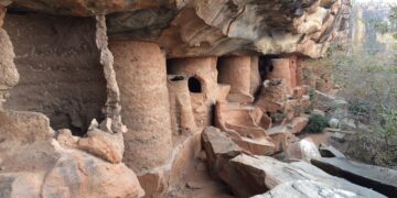
The houses appear as circular huts raised on stilts to protect against dampness or predators and are accessed via stairs. Texts indicate the existence of local leaders who negotiated directly with the pharaoh’s emissaries, suggesting a political entity organised sufficiently to collect goods and secure caravans.
In the last two decades, applied science has helped resolve some of the geographical debate. In 2010, a team of scientists analysed the oxygen and strontium isotopes in the remains of mummified baboons brought from Punt and found in Egyptian tombs. The results showed that these animals were born and raised in areas chemically consistent with the geography of Eritrea, Ethiopia, and eastern Sudan. This study reduced the likelihood of Punt being located in Yemen and strongly supported the “Horn of Africa” hypothesis.
The voyage to Punt presented a significant engineering and logistical challenge for the Egyptians. Ships were not built on the Red Sea coast due to the lack of suitable timber. Instead, parts were manufactured in the Nile Valley (Qift or Thebes) and then transported disassembled on the backs of men and pack animals across the Eastern Desert (Wadi Hammamat) to coastal ports such as Mersa Gawasis.
The Egyptians utilised the monsoon winds to sail south and return north. The journey took several months and required securing freshwater sources along the coast. Excavations in Mersa Gawasis revealed the remains of ship ropes, stone anchors, and wooden crates inscribed with “Wonders of the Land of Punt”, confirming that this site was the main departure and arrival point.
The designation of Punt as “Land of the God” (Ta Netjer) did not necessarily imply that it was a sacred land in a purely religious sense. Rather, it often referred to the direction of the “east”, where the sun rose. Its association with the production of incense, considered the “sweat of the gods” in ancient Egyptian belief, further reinforced this description. In the Egyptian imagination, Punt was a semi-mythical yet tangible place, representing the farthest reaches of the known world and a source of the materials that connected earth and sky (through incense).
Mentions of Punt began to fade from Egyptian records after the end of the New Kingdom (around 1070 BCE). Historians attribute this to several factors. The decline of the central Egyptian state’s influence led to the cessation of costly maritime expeditions. The emergence of the Kushite kingdoms (in Sudan) and later the Kingdom of Aksum (in Ethiopia) transformed Punt from a direct trading partner to a transit region for goods, causing it to lose its independent identity in Egyptian texts. Also, some climatological studies indicate changes in rainfall patterns in East Africa, which may have affected the production of key commodities or population stability.


