


Located in north-central Niger, the Aïr and Ténéré National Nature Reserve is one of the largest protected areas in Africa, covering an area of approximately 7.7 million hectares (77,360 square kilometers). The reserve combines two distinct geographic regions: the Aïr volcanic massif in the west and the vast sand sea of the Ténéré Desert in the east. This topographical and climatic diversity has created a unique ecosystem that supports a diverse flora and fauna, and preserves a rich archaeological heritage dating back to prehistoric times. This led to its inscription on the UNESCO World Heritage List in 1991.
The reserve consists of two main sections. The first is the Aïr massif, a climatic and geographical island in the middle of the Sahara, with peaks rising to over 2,000 meters. These mountains are composed primarily of Precambrian granite rocks interspersed with younger volcanic formations. Over thousands of years, erosion has created deep valleys (locally known as “kouries”), rocky plateaus, and distinctively shaped granite peaks, such as the “Blue Mountains,” which derive their color from the nature of their rocks. These mountains act as a natural barrier, trapping moisture from the monsoon winds, resulting in relatively higher rainfall than in the surrounding desert regions. This allows for a network of oases and temporary water bodies that support life.
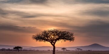
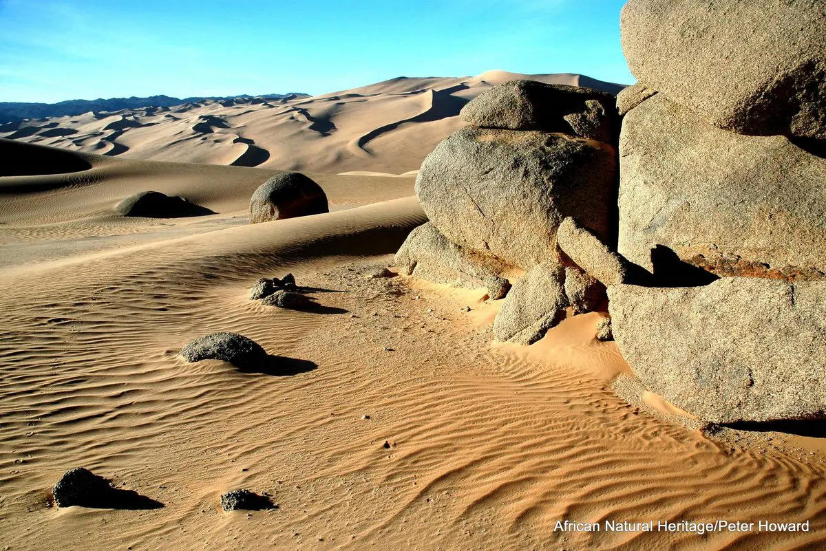
The second section is the Ténéré Desert, which represents the western extension of the Libyan Sahara. One of the driest regions in the world, the Ténéré is characterized by its vast sand dunes known as “ergs,” some of which can reach heights of 300 meters. These sands are interspersed with gravelly and rocky plains (regs), and some salt depressions. This desert was home to the “Ténéré Tree,” an isolated acacia tree long considered the only tree within a 400-kilometer radius and a vital landmark for caravans before it was destroyed in an accident in 1973.
The contrast between the mountainous highlands and the arid desert has created exceptional biodiversity. The Ayr Mountains are a haven for numerous plant and animal species of Sudanese (referring to the geographic region of Sudan south of the Sahara) and Mediterranean origins, which remained isolated in this area after the Sahara desert transitioned to its current arid climate thousands of years ago.
Acacia trees, doum palms, and jujube trees grow in the valleys of Ayr, as well as herbaceous plants and crops grown by local oases, such as wheat, maize, and vegetables. More than 350 vascular plant species have been recorded in the reserve, a high number considering the desert environment.
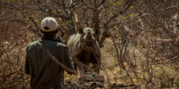
The reserve was once home to large populations of large desert antelopes. However, climate change and poaching have led to a sharp decline in their numbers. Among the endangered species that still exist in very small numbers is the Oryx (Addax nasomaculatus), which is classified as critically endangered, and the reserve is considered one of its last natural strongholds. There are also Dama Gazelle (Nanger dama) which also classified as critically endangered, and the Barbary Sheep (Ammotragus lervia), which species inhabits the rocky slopes of the Ayr Mountains.
The reserve also contains rare predators such as the Saharan leopard (Acinonyx jubatus hecki), foxes, and jackals. Additionally, the area represents a vital corridor for migratory birds between Africa and Europe, with approximately 165 bird species recorded there.
The Aïr and Ténéré Reserve is considered an open-air museum, containing one of the most important collections of rock art in the world. Scattered across the valley rocks are thousands of engravings and drawings dating back between 10,000 and 2,000 years BC. These artworks depict life during the “Green Sahara” period, when the climate was wetter and the region was rich in large animals such as giraffes, elephants, rhinoceroses, and cattle. The drawings depict scenes of hunting, religious rituals, and the daily lives of the communities that inhabited the region. One of the most prominent archaeological sites is the Dabous site, famous for its life-size petroglyphs of two giraffes, considered masterpieces of prehistoric art.
In addition to rock art, dinosaur remains and other fossils have been discovered in the region, providing evidence of ancient geological and environmental history.
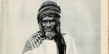
The region is primarily inhabited by the Tuareg people, a semi-nomadic pastoralist group who have adapted to the harsh environmental conditions for thousands of years. Their traditional economy is based on camel, goat, and sheep herding, as well as trans-Saharan trade via the caravan system that connects North and South Africa. The city of Agadez, located on the edge of the reserve, is a historical and cultural center for the Tuareg and a major gateway to the region. Some residents also practice agriculture in the few oases within the Air Mountains.
Despite its global importance, the reserve faces serious threats that led to its inscription on UNESCO’s List of World Heritage in Danger in 1992, a status it remains in today. The region has experienced armed conflicts, including the Tuareg rebellion in the 1990s and the recent activity of armed groups in the Sahel, which have hampered protection and monitoring efforts and made access to large parts of the reserve difficult and dangerous.
Also, the availability of modern firearms and vehicles has led to a sharp increase in poaching, causing the local extinction of some species, such as ostriches, and a catastrophic decline in the numbers of antelopes and gazelles. Overgrazing and logging for firewood and household needs are degrading vegetation, especially in areas surrounding oases and wells. Recurring droughts are contributing to increased desertification and diminishing water resources, placing additional pressure on fragile ecosystems and the livelihoods of local populations.


