


Mount Kilimanjaro is located in northeastern Tanzania, near the border with Kenya. It is the highest point in the African continent, rising 5,895 meters (19,341 feet) above sea level. Kilimanjaro is a unique geological and geographical phenomenon; it is not part of a mountain range but rather a free-standing volcanic massif, ranking among the highest single mountains in the world. , It forms a complex ecosystem ranging from semi-arid plains at its base to the polar ice cap.
Kilimanjaro is part of the East African Rift System, a zone of massive tectonic activity that has led to crustal stretching and volcanic activity. The mountain is the result of the complex volcanic activity of three major volcanic cones that merged together. The first is Shira, the oldest of the three cones, located in the west. Its activity is believed to have begun about 2.5 million years ago. Its activity ceased long ago, and the subsequent collapse of its summit created a broad plateau (the Shira Plateau) about 4,000 meters in height. This plateau has undergone intense erosion, shaping its current topography.
The second cone is Mawenzi, which is located in the east and is the second oldest formation. It is characterized by its steep, jagged peaks and rugged terrain, resulting from glacial and water erosion after its volcanic activity ceased. Mawenzi (5,149 meters) is a technically challenging peak that requires rock and ice climbing equipment and experience.
The third cone is Kibo, the middle and geologically younger cone, and the only one that retains the classic crater shape. Kibo is the tallest of the three cones, and its summit, Uhuru Peak, is the highest point in Africa. Unlike the extinct Shira and Mawenzi, Kibo is classified as a dormant rather than an extinct volcano, as its main crater (Reusch Crater) still emits sulfurous gases, indicating geothermal activity, even though its last eruption dates back hundreds of thousands of years. Kibo’s summit is home to famous ice fields and glaciers, which form the mountain’s distinctive white “cap.”

One of the most extraordinary aspects of Kilimanjaro is its pronounced vertical climatic and ecological gradient. Ascending the mountain offers a journey through distinct climatic zones, similar to traveling from the equator to the North Pole in a few days:
- Cultivated foothill zone (800-1,800 meters): The base and lower foothills have a humid tropical climate. This area is the most fertile and densely populated, and the Chagga people, the traditional inhabitants of the region, cultivate these lands for bananas, coffee, and maize, using a sophisticated traditional agricultural system known as “Kihamba,” an agroforestry system that combines crops with trees.
- Montane rainforest zone (1,800-2,800 meters): Above the cultivated zone, a dense belt of rainforest begins. This zone is characterized by high rainfall, almost constant fog, and a rich biodiversity. Various species of monkeys (such as the black and white colobus monkey), birds, and insects live in these forests. These forests play a vital role as “water reservoirs,” capturing fog and feeding the springs and rivers that millions of people in the lowlands depend on.
- Woodland and Heather Zone (2,800–4,000 meters): As altitude increases and temperatures decrease, dense forests give way to moorland. This zone is dominated by giant heather, which can reach several meters in height, as well as unique plants such as giant groundsel and giant lobelia, plants adapted to the extreme cold at night and the intense sunlight during the day.
- Alpine Desert Zone (4,000–5,000 meters): The climate here becomes extremely harsh. This zone is characterized by extreme aridity, low oxygen levels, and dramatic daily temperature fluctuations (from freezing at night to relatively high temperatures under direct sunlight during the day). Vegetation is extremely sparse, limited to some tough grasses, lichens, and mosses clinging to rocks.
- The Polar Zone or Summit (above 5,000 meters): This is the summit region. Conditions here are polar, with temperatures rarely rising above freezing. The terrain consists of volcanic rock, glacial moraines, and remnant ice fields. Life here is almost nonexistent, except for a few lichens that may be found at extreme altitudes.
Kilimanjaro has long been famous for its gleaming white ice cap, described by early European explorers in the mid-19th century amid widespread doubts about the existence of ice on the equator. These glaciers, such as the Furtwängler Glacier and the North Ice Field, are remnants of past ice ages.
However, these ice fields have become the most visible symbol of the effects of climate change in Africa. Scientific studies and photographic records over the past decades have shown a significant and rapid decline in the area of this ice cap. It is estimated that the mountain has lost more than 85% of its ice cap since the early 20th century.
The reasons for this decline are complex. While rising global temperatures are a major factor, research also suggests that changes in regional climate patterns, specifically declining humidity and snowfall (which feeds glaciers and protects them from solar radiation), play a crucial role in accelerating melting and sublimation (the conversion of ice directly to vapor). This disappearance raises concerns about the loss of a distinctive natural landmark and also about the potential impact on regional water resources, which depend on the mountain’s hydrological system.
For the Chagga people, the mountain (locally known by various names, one of which is “Kilema Kyaro,” meaning “the insurmountable” or “Mountain of Caravans”) was a sacred place and a source of life.
European interest in the mountain began in 1848 when German missionary Johannes Rebmann reported seeing snow on the summit, a report that was met with ridicule in European geographical circles at the time. It took several expeditions to confirm this.
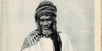
The first successful and documented ascent of Uhuru Peak was recorded on October 6, 1889, by German geologist Hans Meyer and Austrian mountaineer Ludwig Purtschler, assisted by their local guide, Johanni Kinyala Lawo, of the Chagga tribe, whose role was crucial to the expedition’s success.
Today, Mount Kilimanjaro is a major tourist destination and one of the “Seven Summits” (the highest peaks on each continent). The mountain attracts tens of thousands of climbers annually. One reason for its popularity is that, unlike similarly elevated peaks, its summit can be reached via several routes (such as Marangu, Machame, and Lemosho) without requiring technical mountaineering skills, making it a “trek” rather than a technical climb.
The Tanzania National Parks Authority (TANAPA) manages the mountain as a national park, and it has been a UNESCO World Heritage Site since 1987. Tourism associated with the mountain provides a vital source of income for the local and Tanzanian economy, employing thousands of guides, porters, and cooks.


