


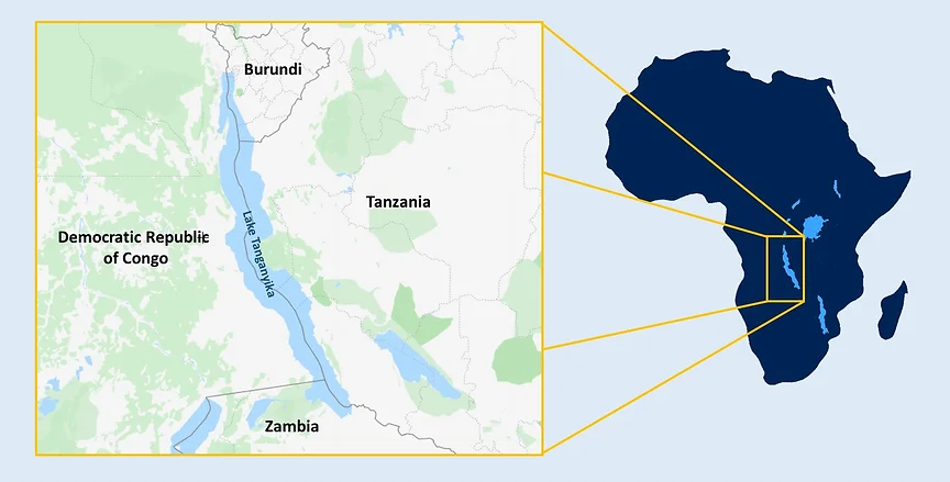
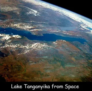
Lake Tanganyika is one of the greatest natural phenomena on Earth. It is a vast body of water and a natural laboratory of evolution, a lifeline for millions of people, and a strategic reservoir of fresh water. Located in the heart of the Great Rift Valley in Africa, its waters are shared by four countries: Burundi, the Democratic Republic of Congo (DRC), Tanzania, and Zambia.
According to Phiri et al. (2023):
“Lake Tanganyika is located within the western branch of the East African Rift Valley. It is the longest and second deepest freshwater lake in the world and is shared by four riparian countries: Burundi (8%), the Democratic Republic of the Congo (DRC) (45%), Tanzania (41%), and Zambia (6%). Lake Tanganyika is confined by the mountainous walls of the rift valley (Bootsma and Hecky, 2003). It extends for 676 km in a general north–south direction and averages 50 km in width. The lake covers 32,900 km², with a shoreline of 1,828 km, a mean depth of 570 m, and a maximum depth of 1,471 m in the southern basin in DRC.”
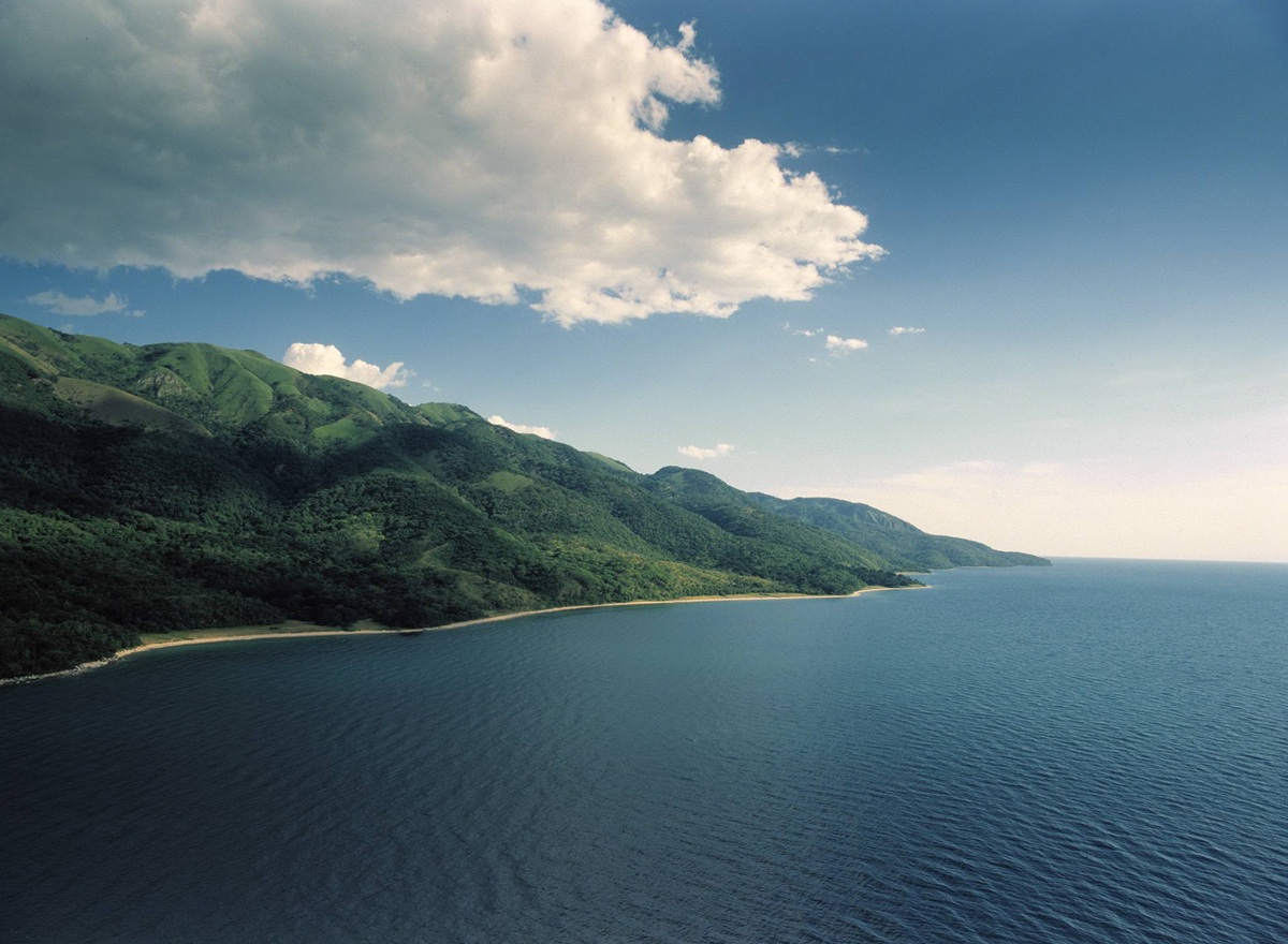
Lake Tanganyika boasts a number of geomorphological characteristics that make it unique globally. It is the longest freshwater lake in the world, stretching approximately 673 kilometers from north to south. Also, it is the second deepest lake in the world after Lake Baikal in Russia, reaching a maximum depth of 1,470 meters.
Lake Tanganyika contains approximately 18.9% of the world’s available surface freshwater, making it the second largest lake in the world by volume. Scientists estimate its age to be between 9 and 12 million years, making it one of the oldest lakes in the world.
Lake Tanganyika was formed as a result of intense tectonic activity in the western branch of the East African Rift System. This rift is a fracture in the Earth’s crust that gradually leads to the divergence of tectonic plates.
Due to this formation, the lake is characterized by steep walls and a narrow, deep bottom, resembling a fjord but on a continental scale. This great depth plays a crucial role in the physical and chemical properties of the water, as the lake is divided into layers of water that do not mix with each other.
Hydrologically, Tanganyika is a meromictic lake, a term used to describe lakes where the deep and surface water layers do not mix periodically.
- The Epilimnion: This is the layer that receives sunlight and oxygen and where fish life thrives.
- The Monimolimnion: This begins at a depth of approximately 200 meters. This water is completely oxygen-depleted and rich in compounds such as hydrogen sulfide, making it unsuitable for most advanced life forms. However, it serves as a vast reservoir of sedimentary nutrients.
The lake’s water supply is primarily derived from seasonal rainfall and river flows, most notably the Ruzizi River from the north and the Malagarasi River from the east. The lake’s only outlet is the Lukuga River, which flows into the Congo River system and then into the Atlantic Ocean.
What distinguishes Tanganyika globally is its astonishing biodiversity and exceptionally high rates of endemism, with over 60% of its organisms found nowhere else on Earth.
- Cichlids: The lake is home to more than 250 species of cichlids. The scientific significance of these fish lies in their evolution from a single common ancestor to hundreds of diverse species in terms of shape, color, and feeding behavior within a relatively short (geologically speaking) period, a phenomenon known as adaptive radiation.
- Other Organisms: In addition to fish, the lake harbors unique species of snails, crabs, shrimp, and even freshwater jellyfish. Nile crocodiles, hippos, and numerous migratory and resident waterfowl also inhabit its waters and shores.
The livelihoods of more than 10 million people living in the Lake Chad Basin depend directly or indirectly on its resources. The lake provides approximately 25% to 40% of the animal protein for the populations of the surrounding countries. The fishing industry is the mainstay of the local economy, with hundreds of thousands of tons of fish caught annually.
The lake serves as a natural highway connecting East and Central Africa. Ports such as Bujumbura in Burundi, Kigoma in Tanzania, Kalemie in the Democratic Republic of Congo, and Mpulungu in Zambia are vital centers for the trade of commodities, fuel, and minerals. Also, it is the primary source of drinking and irrigation water for the major cities and population centers located along its shores.
Despite its size, the Lake Tanganyika ecosystem is fragile and faces increasing threats due to human activity and global changes. Scientific studies indicate that the lake’s waters are warming, which increases the stability of the water layers and prevents nutrients from rising from the bottom to the surface. This leads to a decrease in plankton productivity, which negatively impacts fish populations.
Besides, with the steady population growth, pressure on fish stocks has increased, and some communities have used unsustainable fishing methods (such as fine-mesh nets), threatening the sustainability of resources. Deforestation and unsustainable agriculture in the surrounding highlands cause soil erosion into the lake. This sedimentation buries fish spawning grounds and reduces water purity. Industrial pollution and sewage from urban areas also contribute to the problem.
As the lake is a shared resource, regional and international cooperation is required. The Lake Tanganyika Authority (LTA) was established through cooperation among the four countries bordering the lake, with the aim of coordinating policies for environmental protection and the sustainable management of natural resources. International organizations such as the United Nations Environment Programme (UNEP) also support projects aimed at reducing pollution and raising environmental awareness among local communities.


