


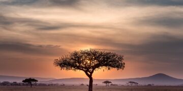


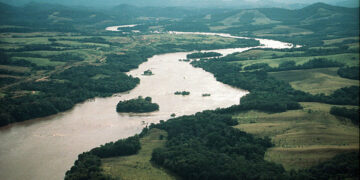
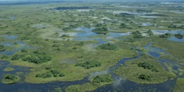
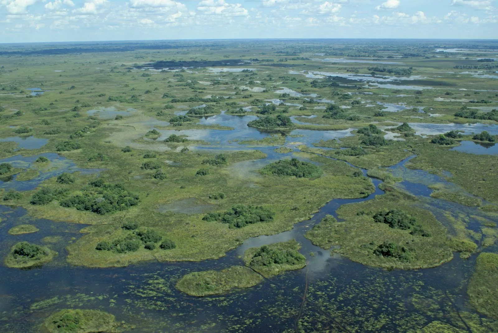
The Sudd region in South Sudan is one of the world’s largest freshwater ecosystems and a unique geographical and hydrological phenomenon in the Nile River basin. The name “Sudd” derives from the Arabic word “السد”, meaning “barrier” or “obstacle”, referring to the dense vegetation and floating islands that have historically made navigation extremely difficult for explorers and sailors. This vast area, located within the White Nile basin, plays a pivotal role in the climatic and environmental balance of East and Central Africa.
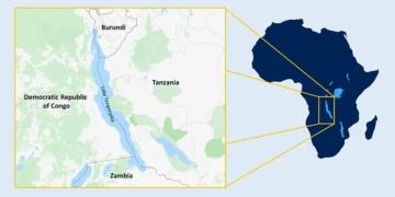
The Sudd region is situated in central South Sudan, where the White Nile (specifically the Bahr el-Jebel) flows from the equatorial highlands in the south into a large basin depression. The permanent area of the swamps is approximately 30,000 square kilometres, but during severe flood seasons, it can expand to cover up to 130,000 square kilometres, equivalent to the size of some small countries.
The Sudd’s hydrology is complex; the White Nile loses approximately 50% of its water as it flows through this region due to evaporation and transpiration. While this process may appear to be a water loss for downstream countries, it is the primary driver of the local ecosystem, which relies on periodic flooding. The region is comprised of a complex network of channels, lakes, lagoons, and marshes whose features are constantly changing based on the volume of inflows from Lake Victoria and local rainfall.
The Sudd is designated a Ramsar site, a protected area under the international convention for wetlands of international importance. The vegetation in the area is dominated by papyrus (Cyperus papyrus), which can reach several metres in height, along with water hyacinth and hay grasses that form floating vegetation islands known as sudd or al-Sudd.
The Sudd is a haven for thousands of species. The area is a strategic stopover for migratory birds travelling between Africa and Europe. It is home to the largest population of the endangered shoebill, as well as pelicans and storks. It experiences one of the largest wildlife migrations in the world, with thousands of white-eared kob and ting migrating across the marshes in search of seasonal grazing. The area also supports populations of elephants, African buffalo, and hippos.
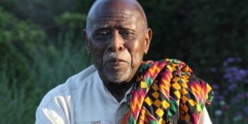
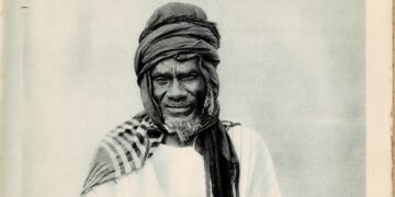
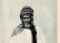
The shallow waters and marshes provide an ideal environment for the breeding of dozens of fish species, making them a vital source of protein for the local population and the terrestrial food chain. The Sudd area and its surroundings are home to major Nilotic ethnic groups, most notably the Dinka, Nuer, and Shilluk. These groups rely on an economic system that combines livestock herding, fishing, and seasonal agriculture.

For the people of the Sudd area, livestock is an economic asset and represents social status. It is an essential element of their cultural rituals. The population follows a transhumance pattern, moving with their herds to the “toic” areas—the wetlands that emerge after the floodwaters recede—in search of rich grass and water during the dry season. This delicate balance between people and nature has persisted for centuries, with villages built on small natural rises to ensure protection from the annual floods.
The Jonglei Canal Project is a controversial water project. Its idea dates back to the early 20th century and aims to excavate a massive 360-kilometre canal to divert a portion of the White Nile’s waters around the Sudd wetlands instead of flowing into them.
The primary objective was to reduce water loss due to evaporation from the Sudd wetlands and provide approximately 4.7 billion cubic metres of additional water annually, to be shared between Sudan and Egypt to support irrigation and agricultural projects in downstream countries.
Actual work on the canal began in the 1970s, but the project was halted in 1983 due to the outbreak of the Second Sudanese Civil War. The canal was a strategic target for armed groups who viewed it as a threat to the local way of life.
Scientists warn that completing the canal could lead to the drying up of vast areas of the Sudd wetlands, causing the collapse of fisheries, the disappearance of seasonal grazing lands, and the destruction of wildlife habitats, as well as potentially altering the local climate due to reduced evaporation rates.
The project remains stalled, and there are frequent discussions about the possibility of completing it in light of increasing water needs, in contrast to strong opposition from environmentalists and local communities who fear for their existence.
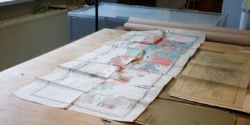
The Sudd currently faces challenges stemming from global climate change. In recent years, the region has experienced unprecedented catastrophic flooding due to rising water levels in Lake Victoria and increased rainfall in the equatorial Nile Basin.
These floods have inundated historically arid areas, displacing hundreds of thousands of people, causing the loss of vast numbers of livestock, and destroying crops. Conversely, the risk of prolonged drought remains a significant threat due to climate variability, making the sustainable management of this region extremely complex and requiring regional and international cooperation.
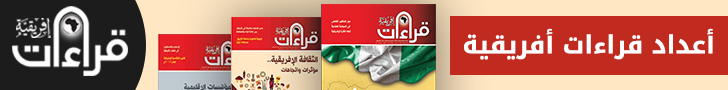
In addition to climate, oil pollution is emerging as a new threat. Some oil fields are located near the swamps, raising concerns about the potential leakage of chemicals into the fragile aquatic system that sustains both humans and animals.
The Sudd’s importance extends beyond South Sudan, impacting the water security of all Nile Basin countries. As a natural “sponge” that helps regulate river flow, the dam plays a crucial role in preventing catastrophic flooding in downstream areas and helps filter sediment and pollutants from the water.
Globally, the Sudd is considered one of Africa’s most important carbon sinks; the dense vegetation absorbs vast quantities of carbon dioxide, contributing to global efforts to mitigate global warming. Any disruption to this ecosystem could lead to the release of significant amounts of greenhouse gases stored in decomposing organic matter underwater.


